“Tawang? Where on earth is that?” was the common query I used to face whenever I would declare my vacation plans of a road trip to Tawang to my friends and family. Since I too had little idea about the place, my common reply to them would be- “Well, it’s the place in Arunachal where the Shahrukh-Madhuri starrer- ‘Koyla’ was shot.”
When we decided to holiday in far-flung Arunachal Pradesh this summer, all we got were strange looks, but it turned out to be one of the most exciting and exhilarating trips ever.
Tawang, is located in the western part of Arunachal Pradesh – the state which is the first in India to greet the morning sun. Largest among the North-Eastern States, it is one of the most sparsely populated provinces of India. And moored high up in the mountain ranges of the Himalayas, at 3500 meters above sea level is Tawang-the beautiful land of Monpas.
With sobriquets like The Hidden Paradise or Land of Dawn-lit mountains; this land evokes images of awesome mountain views, remote hamlets, quaint and sleepy villages, magical Gonpas, tranquil lakes, and a lot more.
Quick Navigation
Road Trip to Tawang
To get to Tawang one has to set up base at Tezpur in Assam, the pretty little town on the north banks of the Brahmaputra. The distance from Tezpur to Tawang is 350 km and the journey takes about 14 hours, covered over two days. The journey to Tawang is a steep ascent most of the way and is barely one lane wide in many places.
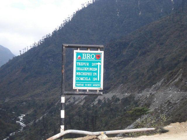
Slippery roads caused by landslides and poor visibility due to mists add to the hazards, besides the added threat of a 20-tonne army truck hurtling towards you around a blind corner!! The road is under the ‘Vartak’ project of the BRO- Border roads Organisation and is maintained by the Army.
Day 1 – Tezpur to Bomdila
It was late in the evening when we disembarked from the bus at the Tezpur ASTC bus stand after a 5-hour drive from Guwahati. It was the first day of our road trip to Tawang. We were greeted by cries of “Bomdila-Tawang, Bomdila-Tawang!!” from the local tour operators running Tata Sumos for the journey.
We went to the Sumo Stand (there are plenty of them) in the ASTC premises and struck a deal with one of the Sumo owners for a 5-days trip. We hired the SUMO from Mr. Dipak Kataki (Sumo owner) (Registered with ASTC- Assam State Transport Corporation) His phone numbers are – +91-9864182449, +91-9435080318, +91-9435381326. As the trip is a long and arduous one, we planned to cover it in two days, with a midway stop at Bomdila (165 km from Tezpur).
As the facilities along the route are just about basic, we stocked bottles of mineral water, some snacks, and other tidbits to munch along and started for Tawang the next morning at 8:30 am. Our first stop would be Bhalukpong. It is situated at the Arunachal border, at a distance of 52 km from Tezpur. Our road trip to Tawang had finally started.
Nameri National Park & Tiger Reserve
After a 25 km drive from Tezpur, we entered a densely forested area – the Nameri National Park and tiger reserve. On both sides of the road, we found armed military personnel stationed at vantage points for providing protection to army convoys from militants in the area.
The Park is best crossed during daylight hours – informed our Sumo driver, for safety reasons. Undeterred by the sad aspect of this menace affecting so many parts of our beloved country, we continued on our journey and could now see the lower Eastern Himalayas in the distance. After an hour or so, we reached the Bhalukpong Check Post.
Also Read: Best Itinerary for North Sikkim – How to Plan your Trip
Bhalukpong
This is the place where our Inner Line Permits were checked and stamped by the security personnel. After the usual queries – “Kahaan se aa rahen hain?” and “Kab tak lautenge?” we entered Arunachal. Arunachal Pradesh is a Protected Area so Indian tourists are required to get an Inner Line Permit (ILP).
One has to keep it handy at all times for hassle-free travel across Arunachal. The dearth of communication, absence of proper tourist information services, absence of proper vehicles for movement in such remote areas, and absence of proper hotels have made the job difficult for tourists.
Yet, the wealth of nature, the flora, and the fauna ever lure nature lovers. The presence of military personnel and their active supervision have curtailed the freedom of visitors in Arunachal to some extent but such things seem natural in strategic border areas with China.
Tipi
Continuing further, we reached Tipi. It is 5 km away from Bhalukpong and Sessa, further away at a distance of 24 km from Tipi. At Tipi, which is situated on the banks of river Jia-Bharali (Kameng upstream) there is an orchidarium and at Sessa, there is an orchid sanctuary.
We stopped at the Tipi orchidarium and saw varieties of orchids in glasshouses. It was an orchid lover’s paradise. The Orchid Research Centre at Tipi gives visitors a glimpse of this exotic plant. Arunachal has more than 600 species of orchids. Some of them like the “Ladies Slipper” variety are indigenous to the land and there is a prohibition on taking them outside the state.
Nechiphu Pass
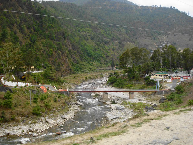
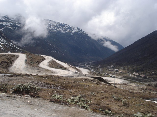
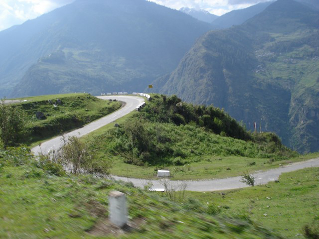
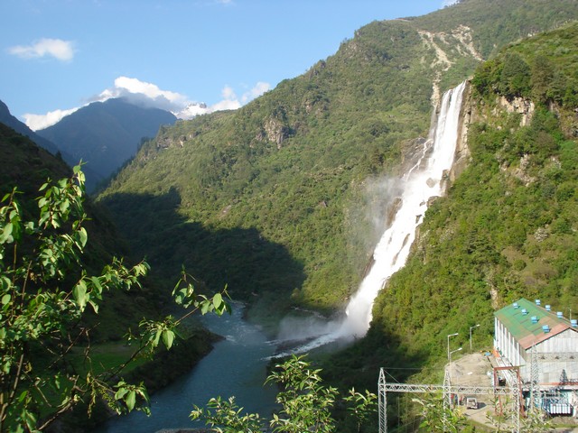
The road now ascended uphill. We slowly inched our way to the Nechiphu Pass situated at a height of 6000 ft. From one mountain range to the other, streams between the ridges, countless waterfalls, rivulets running alongside the road – we moved forward turning and crossing, sometimes hairpin bends and sometimes a dead end. Roads like this were a common sight during our road trip to Tawang.
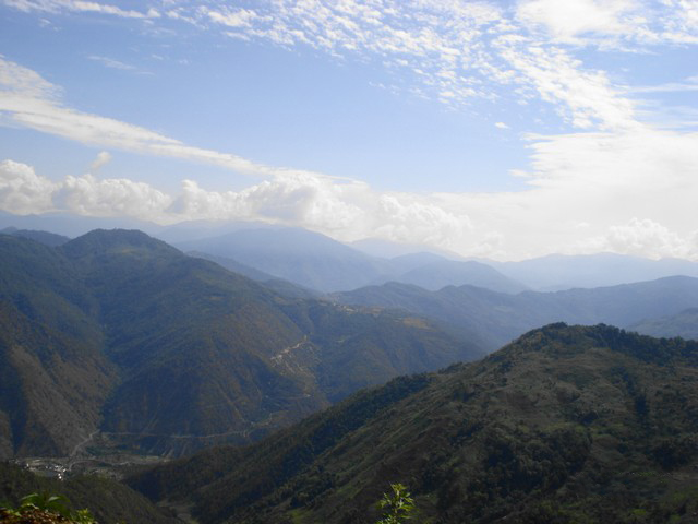
Our Tata Sumo continuously wobbled on the way up, sometimes passing under a jutted mountain body. Our discomforts were suitably compensated and rewarded by unseen spectacular vistas that left us wonderstruck at every turn. We thanked God that our Sumo driver had an experience of over 27 years on this stretch of the road and thus we were in safe hands.
Having crossed Nechiphu Pass, we found ourselves descending. The Tata Sumo’s engine which was gasping and heaving for breath after continuously being driven on the second and first gears now was under lesser strain and could cool down a bit.
But driving downhill on mountainous roads requires even more skills. One needs to keep the vehicle always on gear as well as make judicious use of the brakes to control vehicle run-off. A slight mistake on the turns and our Tata Sumo could have turned into a helicopter without rotors going down the deep canyon.
Thankfully, due to our driver’s skills and the Sumo owner’s maintenance of his vehicle, nothing of that sort happened. We soon we found ourselves enjoying a good hot meal at a roadside shack (read-dhaba).
Also Read: Sightseeing in Gangtok | Best Places to visit in Gangtok
Bhalukpong-Tawang Highway
On the Bhalukpong-Tawang highway do not be on the lookout for resorts or highway inns as in other tourist circuits like Delhi-Manali for example. Eat wherever you get food or be prepared to go without one!!
During our road trip to Tawang, we noticed that all over in Arunachal, women manned (womanned?) the roadside ‘dhabas’. They are proprietors of shops, engaged in road repair and work in the fields. We wondered where the menfolk were?
We also found that these ‘dhabas’ stock 20-liter jerry cans of diesel (albeit illegally). This is mainly because fuel depots are only located at Bomdila, Dirang, and Tawang. The likelihood of finding stocks available at all times is feeble. To prevent being stranded amongst the loneliness of these high altitudes, it is better to keep filling up as and when one can find fuel.
So, like other vehicles tanking up their fuel tanks, we also thought that it would be a smart move to buy a 20-liter can. After cutting an empty mineral water bottle into two, we used the half with the neck as a funnel to fill the Sumo tank.
Man and vehicle having had their full, we once again hit the road. The descent continued to the Tenga military establishment at 4000 ft. Then it was once again a steep climb to Bomdila at 8500 ft.
The sweltering heat of the plains had given way to the cool climes of the Himalayas. We had to roll up the Sumo’s windowpanes to keep out the chill before we could acclimatize to the sudden change in environment.
Bomdila
It was 5 pm when we reached Bomdila. Tired as we were, we checked into a hotel to call it a day. The thermometer in the reception of the hotel which read 18 deg Celsius. Once again, it reminded us of the gaffe of having left our jackets behind. We completely missed warm clothes while we were packing for our road trip to Tawang.
At a height of 8500 feet, Bomdila, the Headquarters of West Kameng district, is inhabited mostly by Monpas, Shredukpen, Aka (Hrusso), Miji, and Bogun tribes. Snow-capped mountain ranges and peaks here have the same beauty and grandeur as in Tawang.
In the middle of the town is a small market, surrounded by high mountain ranges. Those living at higher elevations have to come down by stair-like pathways on foot or to drive down to the place by roundabout routes.
For the people of the North East, however, Bomdila will forever be a symbol of the historical Himalayan blunder. The Chinese invaders reached here during the war. It would have been a cakewalk for them to enter the Assam valley to the south, had it not been a ceasefire called under international pressure.
The lesson has been learned the hard way but learned well. The meticulously maintained roads, the frequent army camps are proof of this. Thus ended the day 1 of our road trip to Tawang.
Also Read: Bike Trip to Darjeeling in Winter – A Ride to Remember
Day 2 – Bomdila to Tawang
The next day, we woke up to the first sun rays filtering through our hotel window. Thinking that it must be around 6 am I got up to get ready for the second leg of the journey. However, we were surprised to find the clock showing 4 am. It was then that we realized why Arunachal is called the ‘Land of the Rising Sun’.
Nevertheless, we did get ready to brave the cold for a morning stroll in the quaint little town. It was bright already. The whole place was freshly washed by the drizzle of the previous night and was picture postcard-like. The sky was a blue we had never seen in the polluted plains. We utilized the time strolling and clicking snaps.
Hotels in the Bhalukpong-Tawang circuit are most basic and services are poor. Don’t expect a bed tea at 6 am as life in this part of the country moves at its own slow pace. We returned to the hotel at 7 am having found a lone tea stall serving tea and piping hot momos.
Dirang
At around 8 am, we started on the second leg of our journey to cover the remaining 181 km to Tawang. The road was once again descending downhill until we reached Dirang, the sub-divisional headquarters in West Kameng District. The National Yak Breeding and Research center is of special interest here. A few kilometers from Dirang are hot water springs where people go for a dip to wash away sins and diseases.
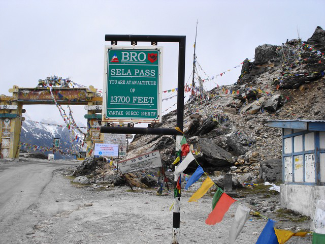
We crossed Dirang after having playfully splashed like 16 years olds in the hot water spring for some time. Once again we started on a long and steep ascent to SELA PASS – the second highest motorable pass in the world.
As the Sumo inched ahead gingerly on the narrow road the huge boulders loomed above, threatening to reduce us to a puff of dust if dislodged. The view was surreal and breathtaking. It was nature in its raw without any frills. The mountains were huge and intimidating closing in on the road. Black granite melded into white at their peaks.
Icy winds and water droplets made patterns in our windshield. Our Assamese driver wrinkled his forehead in concentration as he used his skills to perfection. We silently blew thanks to the Border Road Organization who maintained the road excellently and kept it cleared in the event of the frequent landslides.
Sela Pass
The second highest motorable pass at 13700 ft was no easy task to reach. After endless turns and twists, it reminded us of our driving tests and churning our breakfasts in our tummies. Flitting past shimmering peaks and deep culverts which were dizzyingly steep, our roller coaster ride touched several landslides on the way.
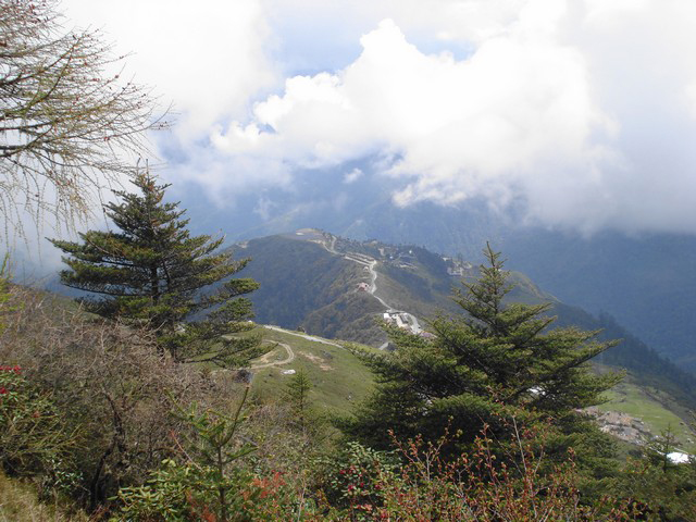
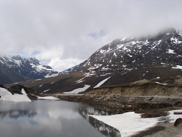
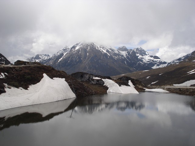
This was the second high-altitude pass of our road trip to Tawang and bewitching beauty. The pass runs through a small ridge and along high-altitude placid lakes of crystal blue water called the Paradise Lakes, decked in both sides with miles of rhododendrons of various hues. Just after crossing the huge gate constructed at the Pass, one finds a complete change in the landscape.
The verdant mountains turn into huge and lofty barren rocks. Snow slowly takes over the landscape, white being the predominant background with a sprinkling of brown or black. It had become quite cold. Both of us were feeling a bit breathless because of the rarefied air at that height.
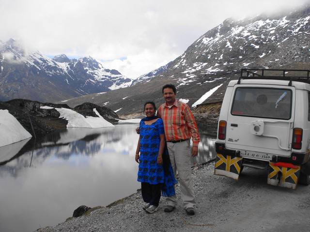
We plodded down to the snow and dutifully threw snowballs at each other. We often hear about the bitter weather conditions that soldiers have to face at the Siachen border in the north. At Sela Pass, we could feel that for ourselves. As soon as we got down, the whining wind and freezing cold almost knocked us out.
We literally scooted to the warmth of the Sumo. The cold was too intimidating without the jackets that we had forgotten to bring on the trip. Soon we were on our way on a descent to the next stop – Jaswantgarh, 14 km from Sela Pass.
Jaswant Garh War Memorial
At Jaswant Singh Garh, the story of the heroism of some Indian soldiers is retold. This is where Jaswant Singh Rawat of the 4th Battalion Garhwal Rifles held off the enemy for 72 hours single-handedly.
He ran from bunker to bunker- firing and creating an illusion of many soldiers present. Two local girls helped him to carry the ammunition. The story goes that rather than give in when the Chinese soldiers were at their doorstep, Singh hanged himself. Army convoys on the way to the border make it a point to stop and pay homage at the beautifully maintained memorial.
Also Read: Gangtok – A Complete Travel Guide and Itinerary
Jung Falls
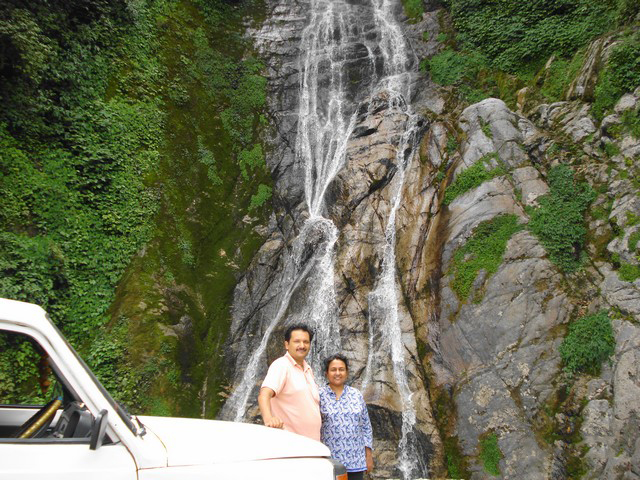
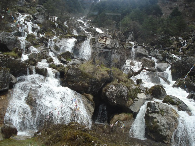
The descent continued till Jung. We stopped by the Jung Falls to enjoy the magnificence of the water cascading in several layers down a mountain slope into the rivulet below. A brilliant rainbow formed just at the bottom of the falls where the waters crashed into the rivulet. After half an hour stop we continued on the final ascent of the last leg of the journey to Tawang.
It was 4 pm when we reached Tawang. The first task was to get to a decent hotel that could provide essentials like hot water, a room-heater, and heavy blankets. Having checked into one, we went about exploring the town.
Tawang
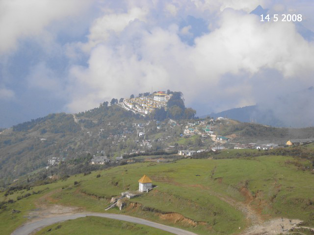
Tawang is a small town with a small city center crowded with a few hotels. There is some military presence at one end of the town, and the monastery at the other end. The 5-6 hotels that one finds around the city center tend to be full most of the time during the tourist season.
There are no upmarket hotels or resorts. So if you are used to comforts, be prepared to live without them while you are in Tawang! To the south of the town, the Tawanchu river carves a deep gorge; as it rages by, while jagged cliffs rise steeply towards the north and snow-capped peaks frame the east.
To the west of town, the Tawang monastery looms across the horizon. Its enormous yellow roof and white walls stand out like a beacon for miles on end.
The local people, the Monpas, are a handsome tribe. They are peace-loving and courteous. Religion plays a dominant role in their lives. There are a number of separate monasteries in this area for Buddhist nuns. As we found out, they follow an even stricter schedule than the male monks.
Despite the greater flow of tourists today and even shooting of Hindi films, this is a world that still retains the pristine beauty of a hidden and unsung paradise.
Day 3 – Sightseeing in Tawang
As we had only one day to spend in Tawang, we planned the day into two halves. The first half would be a visit to the Penga Teng Tso Lake; at a distance of 18 km from Tawang. The second half would be utilized in exploring the world-famous Tawang monastery.
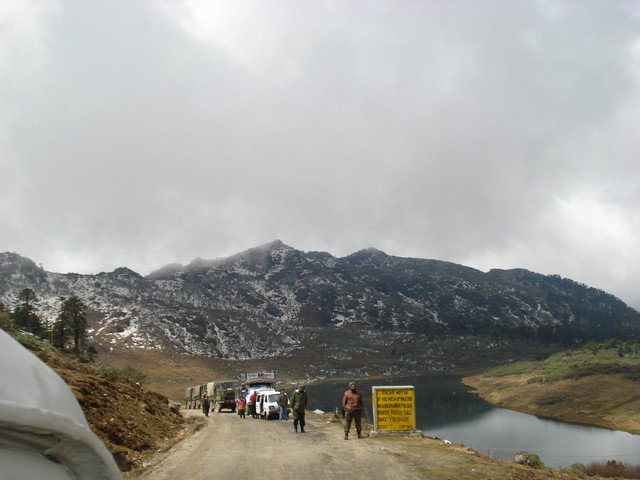
We started for the Penga Teng Tso Lake at 9:00 am after waiting for the morning fog to clear out. As we left Tawang, we were stopped by the Army who checked our ILPs. The road had now become narrower. We had to stop several times on the ascending road to give way to the monstrous army trucks coming to Tawang from the border with China.
Also Read: Best time to Visit Gangtok – When to Plan your Trip?
Penga Teng Tso Lake
Visibility was changing fast from almost zero to crystal clear. The clouds would all of a sudden come to envelop us and then clear as fast as they had come. Rhododendrons in various colors from yellow to bright purple to red covered the mountain slopes all along the way.
The big-bodied Tibetan yaks and Mithun, a mixed bovine creature with a big black body and legs partly white, a native of Arunachal Pradesh grazing on the slopes was a sight to behold.
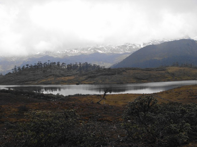
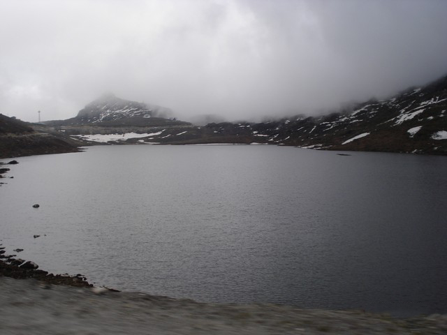
It took us an hour and a half to finally reach the Penga Teng Tso Lake, at a height of 15,000 ft. It is a high-altitude lake surrounded by mountains on all sides. The sunrays reflected from the glistening white snow gave different hues to the landscape. The scenery around was a sight we had never ever beheld.
Eyes were feasting, hearts were expecting, nature was fulfilling our hopes. Mesmerized, hypnotized, and wonderstruck at the awesome sight, we just went berserk clicking the landscape all around the beautiful lake. There was not a man in sight for miles around.
The silence was broken only by the reverberating thunder of the Army artillery being fired intermittently. It was as a practice and perhaps to show our readiness to meet any eventuality; thus deter the enemy from planning any misadventure into our motherland. The weather changed fast at Penga Teng Tso Lake too.
Clouds suddenly coming down the slopes to engulf us, making the lake disappear right before our eyes. It was as if by magic and then vanishing as fast as they had descended.
Tawang Monastery
We returned to Tawang by 2 pm and after having lunch went to visit the world-famous Tawang Monastery (Gompa). Established by Rev Mera Lama Lodre Gyamtso, it is a place for spiritual communion by the followers of the Gelugpa sect of the Mahayana school of Buddhism.
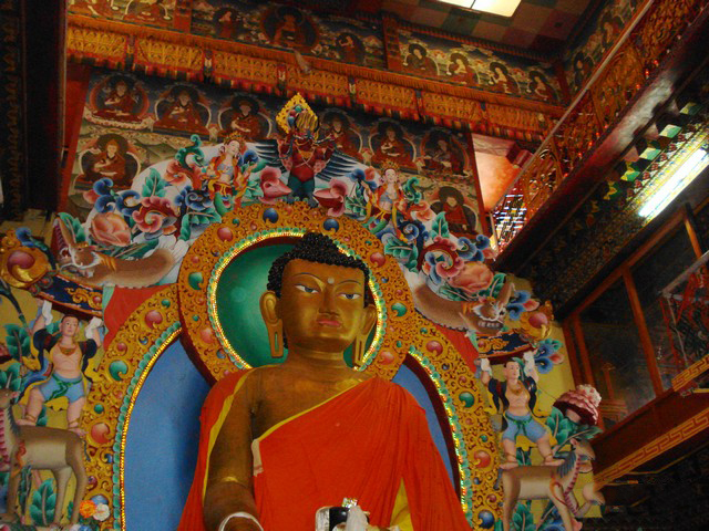
It owes its name to the blessing (Wang) of the Lamas horse (Ta), as the legend goes. Inside the main hall of the Gompa, we saw the 28 feet high golden statue of Lord Buddha. It is the largest Gompa in the country, the second-largest in Asia, and controls 17 Gompas in the region.
The monastery houses more than 500 Lamas and is the birthplace of the 6th Dalai Lama. The present Dalai Lama fled Tibet and took shelter in this monastery in 1959.
Tawang Monastery is one of the most important elements in the social and religious life of the Monpas. This Monastery is known as Galden Namgyal Lhatse. This fortified complex covers an area of 135 sq. meters enclosed by a compound wall of 610 meters long. Within the complex, there are 65 residential buildings and 10 other structures. The library has valuable old scriptures mainly Kanjur and Tanjur numbering 850 bundles. It dates back to the 17th century A.D.
The monastery also houses a museum that has some ancient Buddhist scriptures, very big elephant tusks, artistic goods made of brass and other metals, and wood carvings. Small but interesting, the Museum was worth visiting. The whole atmosphere was of a reverential silence except for the chanting of the monks to pray, meditate and advance Buddhist thought.
As it was late in the evening by the time we finished the monastery tour, it was time to return.
Day 4& 5 – Tawang to Tezpur
The next day we returned to Tezpur by the same route, breaking journey halfway at Bomdila. On the way back to our steel city, we paid our respects at the Kamakhya Mandir, Guwahati to seek the blessings of the Goddess and also for having been able to successfully complete the most memorable road journeys of our lives safely.
Pictures from my Road Trip to Tawang
Raod Trip to Tawang – Conclusion
I hope the travelogue, pictures, and information on planning a road trip to Tawang were of help. If you have any questions or need any other details, please feel free to ask in the comments section below or at our Community Forum, and I will be glad to answer.

1 comment
Which month did u traveled to tawang