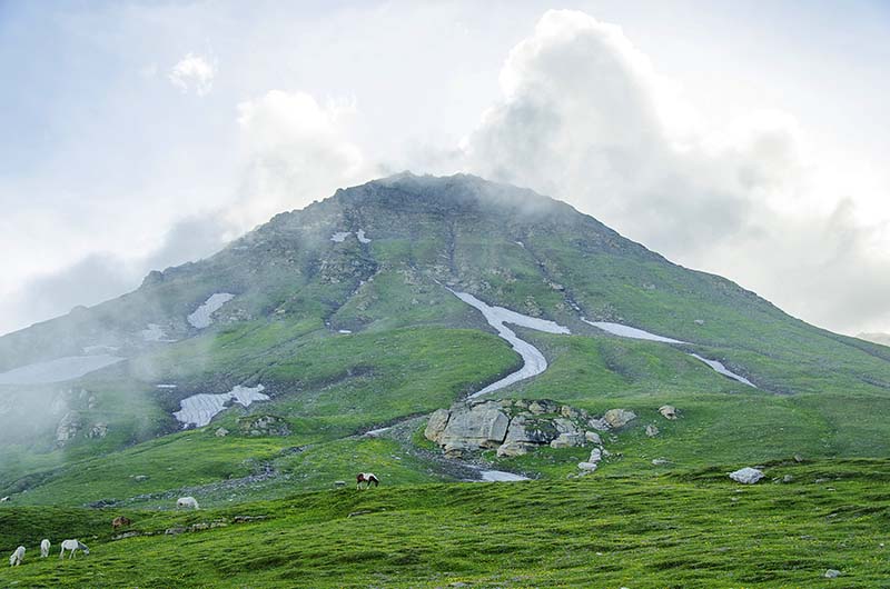
There are a total of 5 high altitude passes on Manali Leh Highway. Starting from Manali, Rohtang will be the first pass that you will cross and Tanglang La will be the last one. Of these 5, Tanglang La is at the highest altitude; but it is Baralacha La that is considered to be the most difficult and receives the highest amount of now each year.
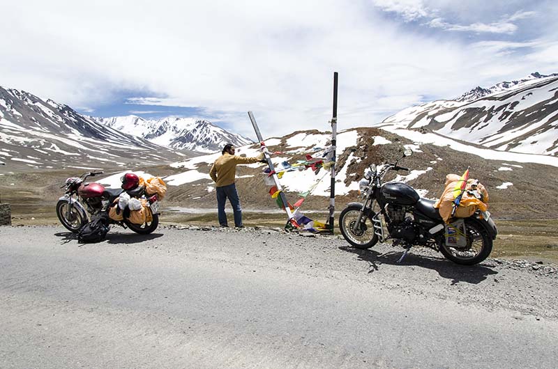
Even before Ladakh became the hot favorite tourist destination that it is today, the passes on Manali Leh highway were its greatest tourist attraction. Whatever little tourism that Ladakh received in those days was because of these passes. Bikers will travel from Manali to Leh by road as an adventure. The challenging nature of the road, the uncertainties, and its mountain passes were considered an accomplishment in itself.
Things have changed a little now. Other places in Ladakh like Pangong and Nubra Valley have now come into the limelight but the passes on Manali Leh highway are still the adventure that they were back then.
Quick Navigation
Passes on Manali Leh Highway
Please note that in this article, I will only provide information on the high altitude passes located on Manali Leh Highway. For other details on traveling on this route, please read How to Plan a Trip from Manali to Leh.
1. Rohtang Pass
Rohtang Pass needs no introduction. It is probably the most famous and the most visited of all the passes in our country. Half of the tourism in Manali is only because of Rohtang. People arrive in large numbers in the months of May and June because this is one place where they know that they will still find snow. The pass is well connected by a good motorable road and is easily accessible.
As you start your journey from Manali to Leh, this will be the first pass that you will cross. It is located at an altitude of 3,978 meters (13,051 ft) and at a distance of 51 kilometers from Manali. Natural water springs, waterfalls, lush green mountains, snow-capped peaks, water crossings, charming scenery, adventurous roads – you name it and Rohtang has it all.
If you didn’t know, the name of the pass literally means’ A Pile of Corpses’ which proves that a lot of people must have died while trying to cross the pass in old days. For more information on Rohtang, Please take a look at How to Plan a Trip to Rohtang Pass.
2. Baralacha La
Of all the passes on Manali Leh Highway, Baralacha La is the one that is considered the most unpredictable one. I earlier mentioned in the article that it is the most difficult pass but that is not in terms of the road or the climb. In fact, the road across the pass is an amazingly smooth one and the climb is not that difficult either.
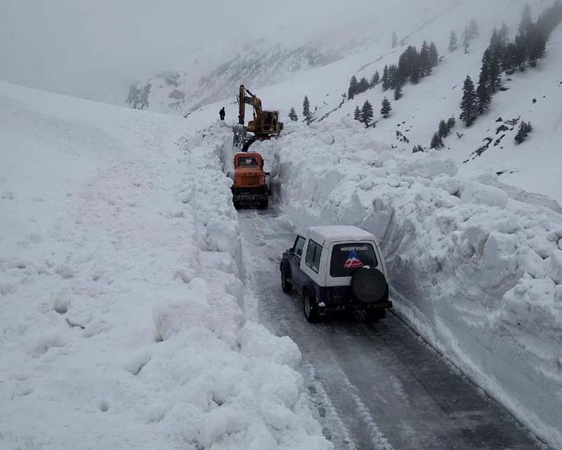
But Baralacha La is difficult in the sense that it receives the highest amount of snow in the region, as much as 50 ft or more. This is the first pass on the route to get closed and the last one to open. Clearing snow from Baralacha La is the most challenging task for the BRO team working on the highway.
The name of the pass literally means ‘summit with crossroads’. It is said that in ancient times, it was part of a trade route. People from Spiti, Ladakh, Zanskar, and Lahaul used to meet here for trade. The elevation of Baralacha La is 4,890 meters (16,043 ft) and it is at a distance of 140 kilometers from Rohtang Pass.
On your way to Baralacha La, you will cross the beautiful lake of Deepak Tal. At the top of the pass is another beautiful lake called Suraj Tal which is the source of the Bhaga River. What is even more interesting though is that there is even a ghost tale related to Baralacha La. Intrigued? Take a look at Baralacha La – Travel Guide and Sightseeing for more details.
3. Nakee La
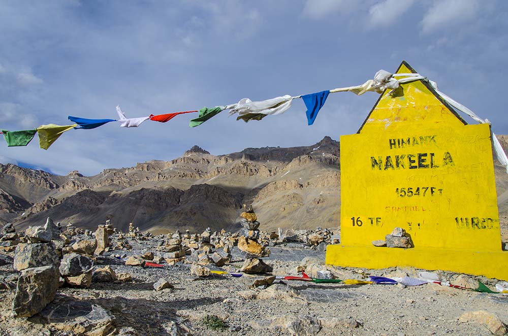
The third pass on Manali Leh Highway is called Nakee La. It is 68 kilometers after Baralacha La and at an altitude of 4,739 meters (15,547 ft). The pass is marked by a series of 21 hairpin bends called the Gata Loops.
After crossing Baralacha La, you will drive down and travel on an almost flat road for a while. You will cross the border of Himachal at Sarchu and enter the Union Territory of Ladakh.
About 23 kilometers after Sarchu, you will reach the bottom of the Gata Loops. One by one you will drive up the 21 bends while gaining a significant amount of altitude and arrive at the top of Nakee La.
Other than being an adventurous climb on the loops; what also makes Nakee La famous is the ghost story related to it. There is even a temple dedicated to the ghost on one of the loops. Take a look at Nakee La – Travel Guide and Sightseeing for more details.
4. Lachulung La
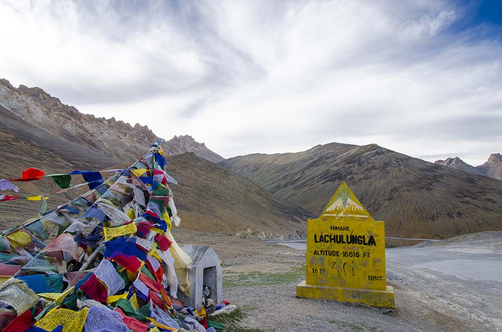
The next pass that you will cross after Nakee La is Lachulung La, at an altitude of 5,059 m (16,598 ft). Even though it is higher than all three passes that you crossed before it, it is also the easiest of them all. In fact, if it wasn’t for a stone marker at the top, you would not even realize that you just crossed a pass.
It is because of the short distance of 18 kilometers between Nakee La and Lachulung La. When you are at Nakee La, you are already at an altitude of 4,739 meters. After that, you drive down for a bit (about 8 kilometers) and then you drive up again for 10 kilometers to Lachulng La. The gain in altitude is only 320 meters and you would not even know that you are at a different pass now.
The road conditions around both these passes are the best that you will come across on the entire Manali Leh route. It is also here that you will feel like being in the middle of nowhere. You also have a great chance of seeing wildlife around Lachulung La Pass. For more details, please read Lachulung La Pass Travel Guide.
The stone marker at the top of the pass reads the altitude as 16,616 ft which actually is incorrect. The elevation of the pass is 16,598 ft.
5. Tanglang La
The last pass on Manali Leh Highway is Tanglang La. After Lachulung La, you will drive down all the way and arrive at the tented accommodation site of Pang. A short climb from Pang will bring you atop a plateau called More Plains. You will drive through the beautiful plains and then climb up Tanglang La, the last pass of the journey.
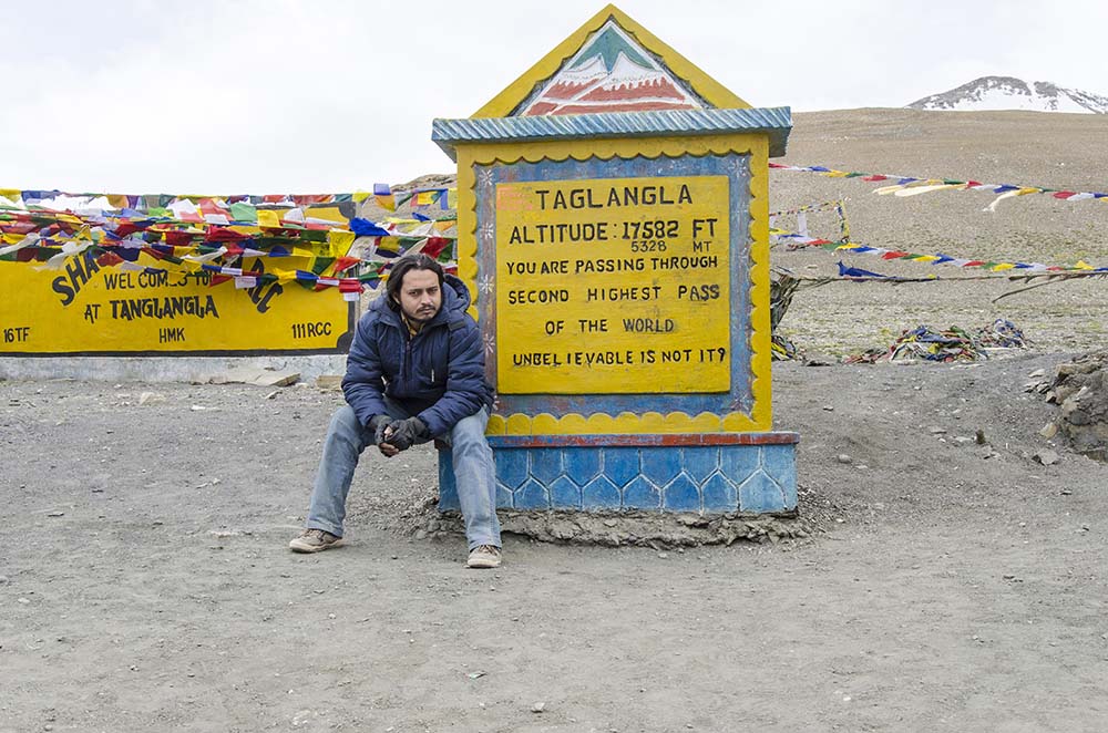
The actual elevation of Tanglang La pass is 5,328 meters (17,480 ft). The board at the top of the pass claims the altitude to be 5,358 meters (17,582 ft) which is incorrect but just slightly different.
The board however also claims Tanglang La to be the second-highest pass in the world which is actually incorrect. There are several other passes that are at much higher altitudes. Recent claims put Tanglang La at the 12th spot in the list but even that can be disputed. Take a look at Highest Motorable Roads and Passes in the world for more details.
After Tanglang La, you will drive down to Upshi. From there, it is a straight run to Leh on a smooth and almost flat road. For a list of places that you should visit on this stretch, please take a look at How to Plan a Trip to Tanglang La.
Passes on Manali Leh Highway – Conclusion
I hope the information above on passes on Manali Leh Highway was of help. If you have any questions or need any other details, please feel free to ask in the comments section below or at our Community Forum, and I will be glad to answer.

